Nirona Fm
Type Locality and Naming
Subsurface: Interval 1710-2210 m in Well Nirona-1 (Zutshi et al., 1993)
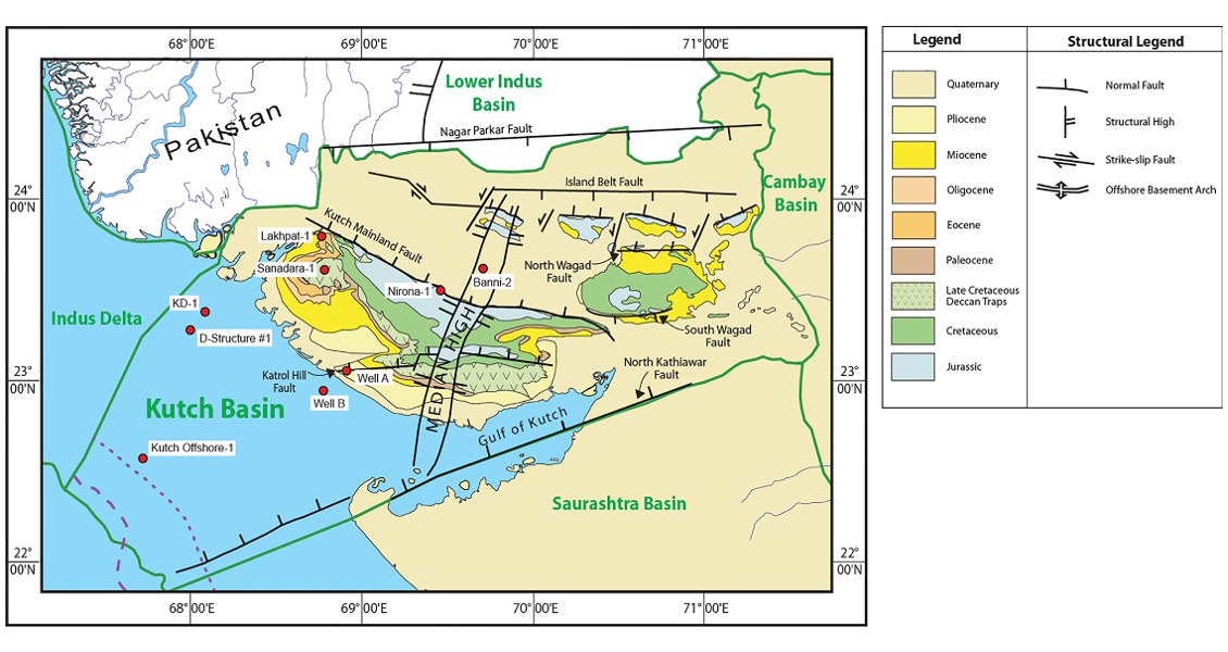
[Fig. Geological and structural map of Kutch, also showing the onshore and offshore wells drilled for oil exploration. (Map by Rasoul Sorkhabi in GeoExpro Dec2014, based on various sources including S.K. Biswas, Current Science, 25May2005)]
Lithology and Thickness
Conglomerate. Conglomerate, sandstone with weathered reddish brown rock fragments with bands of siltstone and very thin limestone. In Banni-2 the formation also contains orthoquartzite sandstone. 470 m in the type section, in Banni-2 area the thick is only 293 m
Relationships and Distribution
Lower contact
Lower boundary in non-conformable with the Precambrian basement. Precambrian basement forms the floor of the Kutch Basin and is exposed in Meruda Hills, and Nagar Parkar hills in the northern part of the Basin. In the sub-surface the basement have been encountered in wells Banni-2 and Nirona-1.
Upper contact
Upper contact in Banni-2 in unconformable with the Lodai Fm
Regional extent
GeoJSON
Fossils
The formation is devoid of microfauna. Some Palynofossils assemblages have been reported
Age
Depositional setting
Continental
Additional Information
